
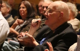
Cruise on over to this celebration of of...

Road papers hit the road
The roads that we now take for granted, were not always so. In fact, it often took a Herculean effort on the part of many different property owners to get them created in the first place.
Ernest J. Varga, design engineer with the McHenry County Division of Transportation, said the first potential pothole in calling for a new road was reaching a consensus. All of the property owners from a given area had to agree, and they had to pony up the fees necessary to have their petition heard before the board of commissioners – the equivalent of today’s county board.
“The commissioners would then put out a public notice which was posted at the county courthouse and at the township hall of the given township,” Varga said. “The county wanted to make sure it wasn’t just for one person’s benefit.”
In the course of doing other research last year for the county at the McHenry County Historical Society’s Research Library, Varga learned about early “road papers” for Marengo Township within the MCHS collection. Since the MCDOT and the county records and archives department had worked previously with the Illinois State Archives to recover and digitize similar papers about 10 year ago, it was clear that a proven procedure existed to permanently preserve these documents for public use.
As McHenry is the only county in the state known to still possess such records, the Illinois State Archives was eager to undertake the preservation process. In cooperation with the McHenry County Records and Archives Department, the historical society relinquished 91 envelopes containing some 120 pieces of paper. The records include original petitions, sketches, contention papers, public notices; even a rare denial of a road request by the county.
It was the first time Varga ever came across the latter.
If commissioners found a petition had sufficient merit, it appointed three “viewers” to inspect the site and determine the best spot for a road. There could be lowlands, poor soils, productive farmland and challenging topography to negotiate, Varga said, and there undoubtedly was some lobbying on behalf of particular landowners. The result still can be seen today, with unusual bends and twists within the roads, first put into place to bypass trees or adhere to the perimeter of some property lines.
“There was no further compensation beyond the road for the area and its use for rights of way back then, Varga said.
The viewers shared their findings with the county surveyor, who actually completed the lay out of the various roads, thereby establishing their width and length.. Road names often reflected geographic destination, the owners of a nearby farm, an existing use (Mill or Grange, for example) or a topographical feature of note, such as Deep Cut Road between Harvard and Woodstock.
Once the Illinois State Archives finishing scanning each paper, it will provide electronic copies of the material to historical society and county. The originals will be sent to the state archives at Northern Illinois University in DeKalb.
The McHenry County Geographic Information System Department will add the new scans from Marengo Township to its existing McHenry County Historic Documents Viewer (mchenrycountygis.org). Thus, a process begun in the 19th century will come full circle – returning records originally created for the public back into its hands.


28 Feb 23
Related News
Recently Added News

")
")
Recently Added Exhibits


![]() © 2025 MCHS- All Rights Reserved.
© 2025 MCHS- All Rights Reserved.